As David Moore did not have a page covering Hardway, I have taken it upon myself to add one; I hope that he would approve. I must thank Philip Eley, a ‘proper’ local historian, for his valued assistance and guidance with my project.
Hardway is an area of Gosport which takes its name from the ‘hards’ which were built to facilitate the loading and unloading of boats. The shorelines of Portsmouth Harbour are predominantly mud flats which prevent boats from landing unless the tide is in full flood. The building of hards would have been done before we were building piers, so could go back as far as Roman times. As many as seven shingle hardstandings extend from the shoreline toward the main channel ending in a ‘T’ shape against which vessels would have been able to moor. It is possible that these hards are a natural phenomenon, but I favour the theory that shingle from the shoreline of The Solent was carried to Hardway and dumped onto the mud to form the hardstandings. The hards are along a stretch of the foreshore from Burrow Island1, locally known as Rat Island, in the South, northwards just to the north of Fort Elson. I can imagine that at one time the hards were much higher forming substantial wharfs, but time and tide would appear to have diminished them to a token of what they once were. Once piers had been built, there would have been no need to maintain them, so they decayed. Careful inspection of Google Earth enables one to see where these hards were located. At low tide it is possible to walk out onto these hards, but care must be taken not to stray onto the mud as it is all too easy to get stuck. It is not unknown for emergency services to be called to rescue people from the mud. Incidentally, if you are unfortunate enough to get stuck in the mud, do not try to pull your feet out while standing: fall onto your back and wriggle your feet while straightening your legs until your feet are clear, then crawl back to safety.
These maps show Hardway over the years:


Apart from loading and unloading, a hard would also be used for the careening of vessels. This involved removing all that could be from the hull of the ship, then, with the help of capstans and cables, laying it onto its side. This enabled the ship’s bottom to be cleaned of weed, the ship worm to be eradicated using fire, and the hull to be treated to offer some future protection. As far as I am aware, this was not done in Gosport, but it was certainly done in Portsmouth regularly.


The most southerly of the hards is Priddy’s Hard which gave its name to the Ordnance Yard which was created in the 1750s. The name came from Mr John Preddy, who in 1748 had taken out a 40 year lease from Thomas Missing for 11 acres of ‘furze-land’ (furze is another name for gorse). John died in 1751 and is buried at St Mary’s Church in Alverstoke, as is his second wife, Jane and his first wife Elizabeth. Jane Preddy inherited the lease.
An act of parliament in 1757/8 was passed to acquire just over 25 acres of furze-land on the north side of Forton Lake from Thomas Missing, just over 14 acres of arable land, from Price’s Charity in Fareham, and a wharf jointly owned by Thomas Missing and Jane Preddy for building fortifications.
 to Burrow Island on the right.")
Burrow Island, on which a 14 gun fort: Fort James, built in the 1670s, existed, was incorporated as part of the fortifications. In November 1763 there was an order to build one magazine, a cooperage, and a wharf at Priddy’s Hard. The new magazine, known as ‘The Grand Magazine’, was built in 1771 following repeated complaints to the Admiralty from the people of Portsmouth dating back as far as 1716, who were worried that an explosion in the Square Tower, where the navy’s powder store had been since the 1500s, would obliterate the densely populated town of Portsmouth. The site was further extended westwards in 1794, and further still in 1815.
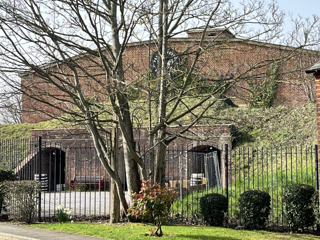
The Grand Magazine building, still very impressive with its eight foot thick walls and huge buttresses, is now part of The ‘Explosion!‘ museum, and is used for functions such as weddings, parties &c. It is surrounded by a display of retired armament.


The brickwork of the Grand Magazine and the blast wall to the south is interesting. In the 1770s bricks were usually made locally using locally dug clay. The brick clay in Gosport is bright orange and makes dark red bricks, however, these walls are made of a mix of dark red and black or grey bricks. The way that they were laid is also unusual with alternate layers being laid laterally or longitudinally. One must assume that this was to allow for a thicker, stronger wall with the bricks locking themselves together. The whole structure is mostly in excellent condition with little sign of decay.


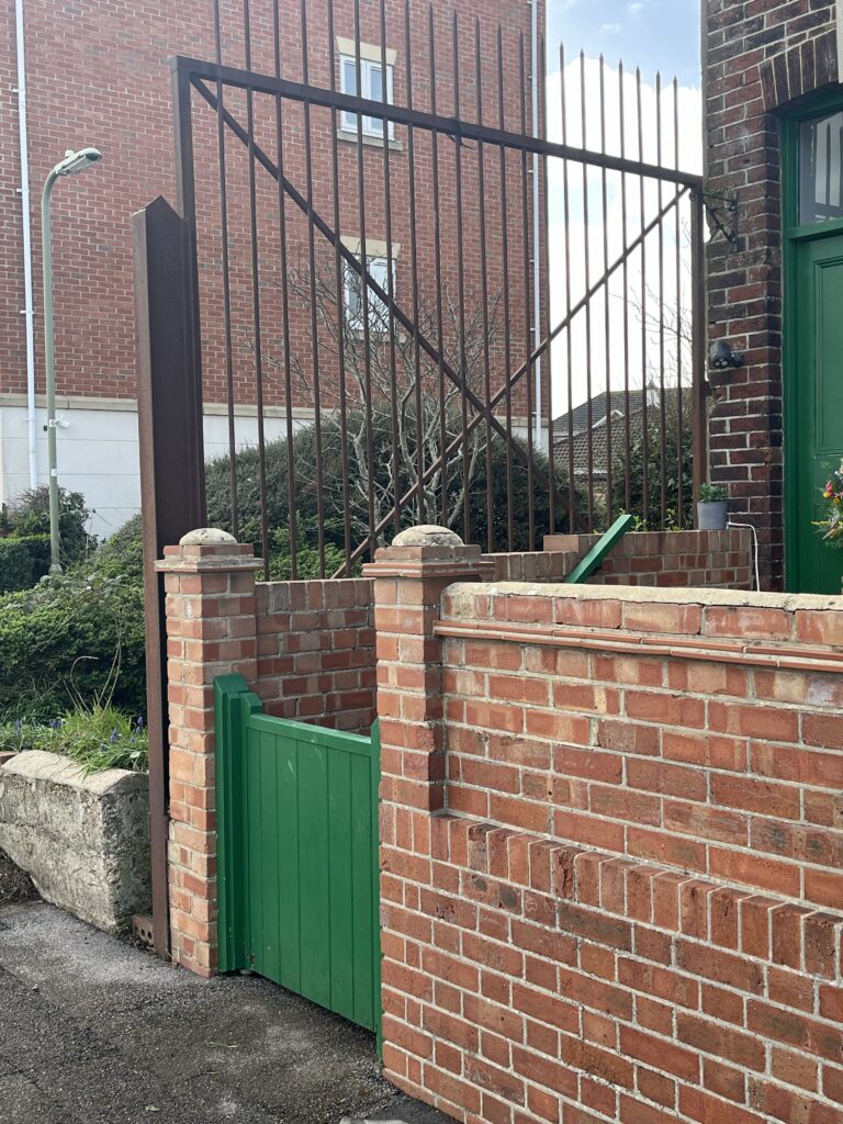
The blast wall, built to the south of The Grand Magazine, presumably to protect the beautiful office block should the magazine explode, was at one time fitted with a pair of blast doors.


The pintles that supported the doors, and brackets that held the drawbar can still be seen, as can the hooks that would have held the doors in the open position, or maybe the hooks held the drawbar in position.


The last of the above photos shows the bottom right pintle, but also the granite block protecting the corner of the wall from the wheels of wayward carriages.
Near to the door of the museum, and inside the museum itself, the keen eyed will spot some Napoleonic graffiti. Soldiers have carved their names, and that of their regiments, into the bricks. Unfortunately time and frost has erased much of their work, but we can make out the remains of a name ending in ‘HANT’ and a date: 1806, on another brick: ‘Morgan W’, also ‘Royal Dublin’ followed by ‘Ma’ (I presume his to indicate Royal Dublin Militia, or The Royal Dublin Fusiliers created in 1881). Perhaps you can spot more names among these photos taken in 2026?


The last of these engravings is John Cockerham, spread over three bricks, it is difficult to read today, but the following photo, taken in 2015 by Philip Eley, clearly shows John Cockerham’s name followed by ‘ndm (North Devon Militia) 1801’.

Some of the original signage remains. Here are a few, but many more can be seen.

Alongside one of the two original hards, just to the south east of the magazine, a camber dock (a wharf) was built, and a passage dredged to the deeper water, with a dolphin marking the entrance, to enable vessels to dock easily in all but the lowest of tides. Boats would have tied up to the dolphin at very low tide to wait for the water to rise.

Having moved the powder magazine from Portsmouth, another magazine (Magazine E) was built in 1879, and other ordnance facilities, such as laboratories2, were also transferred from Portsmouth to Gosport. These facilities continued to expand, many buildings can still be found around the site along with the remains of others that have been demolished. Two piers were constructed, one at the point where the causeway to Burrow Island began, and the second just to the north of the camber dock. These ensured that access by sea was possible at all states of the tide.
North of The Grand Magazine, immediately outside the main gates, and to the east, one can see what remains of the defences built in the 1750s. A ditch, which fills with water with the tide, and a set of firing points opening both across the ditch, and over the harbour.


A railway was built in 1904, running from Priddys Hard, northwards to Bedenham where it connected with the national rail network. Maps from the late 1930s and onwards did not show any of the buildings in Priddy’s Hard, nor the railway. However, the route of the railway can be followed on the map below (also on the map above from 1930). The pink line shows the route that it followed, much of the route now followed by Heritage Way. Incidentally, all but one of the seven hards can be seen on this map.

Priddy’s Hard remained an ammunition factory until 1988. Land was sold off, and the fences came down. There is a small piece of the old perimeter fence remaining. Reportedly, this was, retained at the request of the lady who lived in the cottage next to the fence when it was being removed. Beside this were once the guard house and the main gate, guarded by a pair of small mortars; nobody could pass this point without permission.
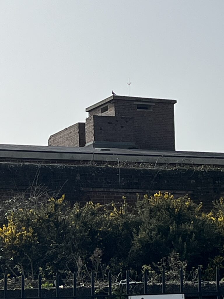
The yard now houses the ‘Explosion! Museum of Naval Firepower‘, and, in the recently restored powder magazine, Magazine E, The Powder Monkey brewery operates. On the roof of Magazine E a small observation post can be seen. This was built in the second world war as an observation post for the Home Guard platoon who were stationed there. Occasional tours of the site are arranged by Gosport Heritage during the summer time.
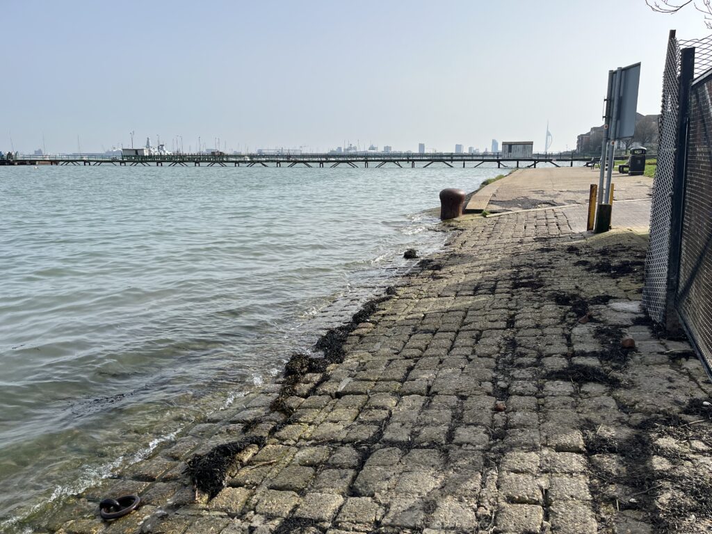
Of the two piers belonging to Priddy’s Hard, only the southern one remains, but, although still in use, it could not be described as ‘in tact’, of the northerly pier, only the remains of the pier head and a few piles are still visible.
The north pierhead:

Here we can see that the tide has washed the shingle from the hards onto the shore:

The remains of a wooden minesweeper, M113, can be found a short way to the north. Very little remains other than the keel, but I can recall when it was recognisable as a ship. Many of these wooden mine sweepers were built during WWII and discarded when hostilities ended. Another can be found in Forton Lake to the west.

Another hard is clearly visible, directly opposite The Jolly Roger public house, either side of which two more piers stand.

The Northern of the two piers (on the left in the picture) belonged to Vosper’s, the shipbuilder, and the other is owned by Gosport Boatyard. The Jolly Roger pub is thought to have been the haunt of smugglers, so that may be the reason for the hard having been constructed. This is quite likely as Hardway would have been a quiet hamlet, well away from the authorities across the harbour in Portsmouth, and separated from the rest of Gosport by farmland. Locals will tell you that the pub was once called The Rose and Crown, On a map of 1856 another pub, The May Flower, is clearly marked this was a short distance from The Rose and Crown. Beside the Jolly Roger is a narrow alleyway leading to a group of little cottages. The alleyway is known as “Shotters’ Alley”. It is said that the alley is so called because the local people would use the alley to access the foreshore and search for cannon balls fired by the navy during gun practice. These were collected, and sold back to the navy.

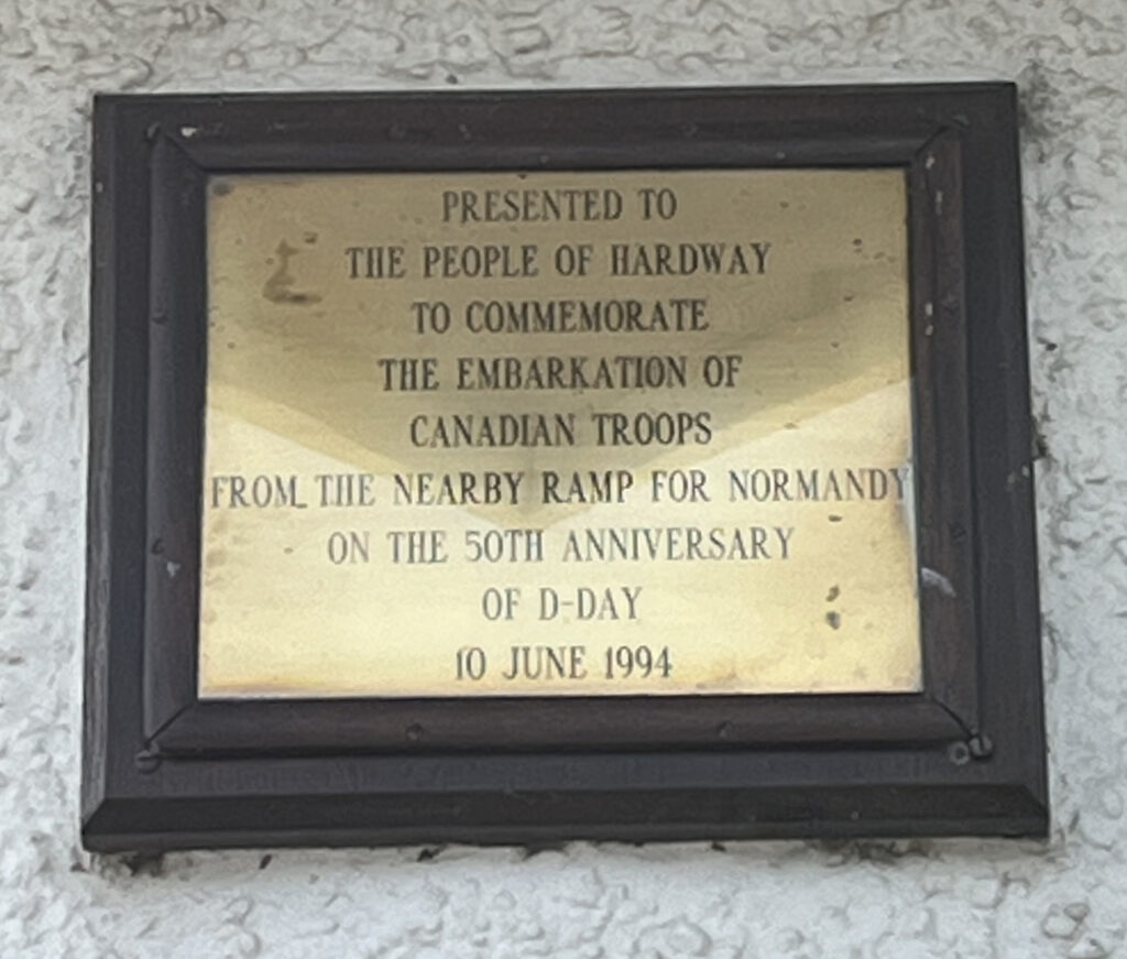
Still moving north a small commemoratory garden area can be found remembering the forces that embarked from here for the D-Day landings, and those who did not come home.


Something that most visitors will completely miss are the remains of a large wooden warship that was beached here many years ago, presumably to have all recyclable parts removed. What remains are the stumps of her ribs, I’ll wager that there are cannons, used as ballast, buried in the silt. A bit of a sad end to what was probably an heroic vessel. Keep looking; you will see it.

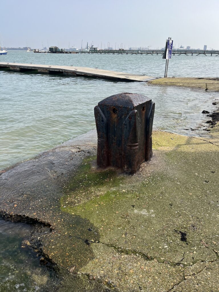
Much of the ‘chocolate block’ concrete slipways built during WWII can still be seen, along with bollards and ring bolts for securing the landing ships. This area is now dominated by Hardway Sailing Club. Two pontoons provide landing stages for boaters, one is council owned, and the other, longer pontoon, is for the exclusive use of Hardway Sailing club. I learned to swim between these pontoons; well you have to if someone pushes you in!
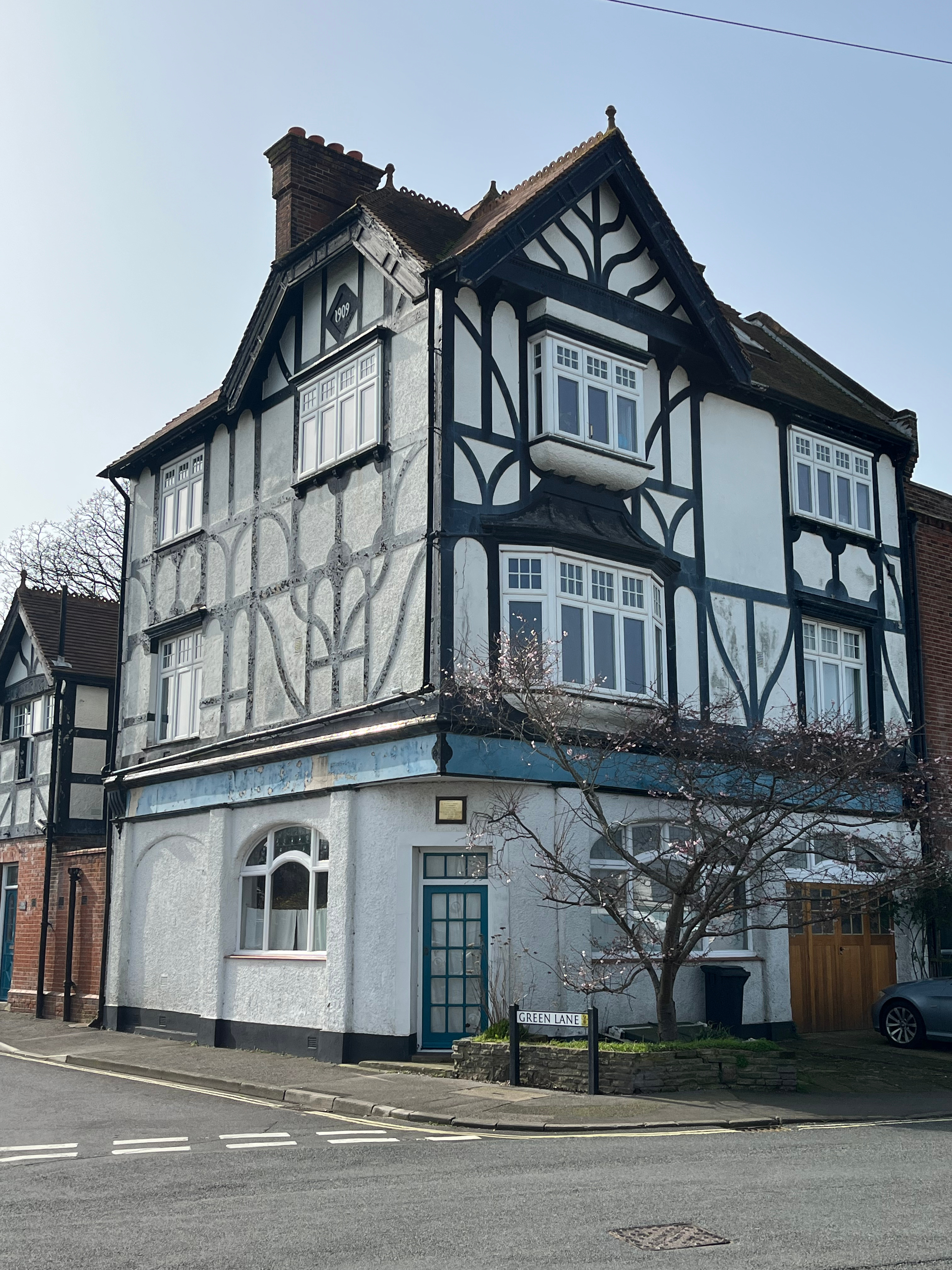
Overlooking the sailing club is a group of three story Georgian houses. There were five of them, known as Carter’s Terrace, but two were demolished to make way for, the mock Tudor, Moby House, formerly a public house called The White Heather. You can see Carter’s Terrace marked on the 1930 map above.
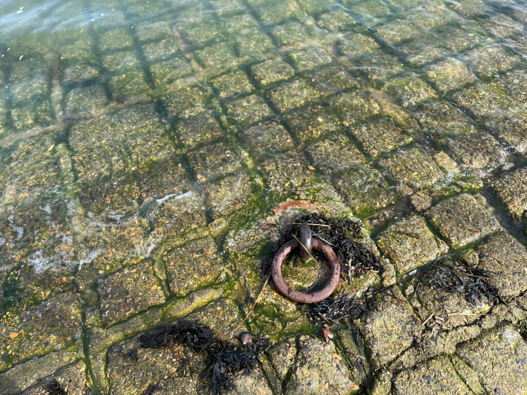
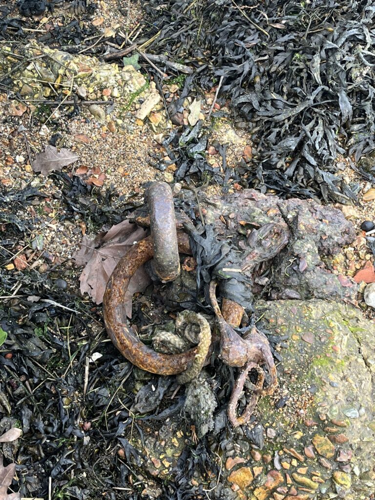
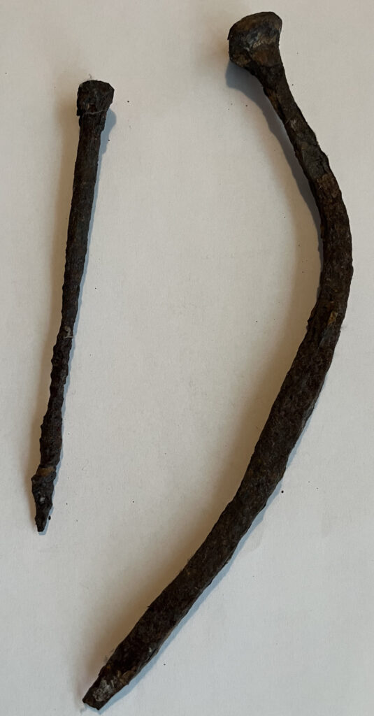
Immediately north of the sailing club one can just make out another shingle hard. A ring bolt set into the beach hints at the purpose of this hard. Ships that had reached the end of their useful life were purchased by enterprising folk who would haul them up onto the shore and dismantle them so that their component parts could be sold. Useless items would have been left to rot on the beach. One can often find hand forged ship nails and other items amongst the shingle.
A steep alleyway leads up from the beach to the road. The house opposite the alley, now a builder’s yard, was once the home of Jack Munden who would buy scrap timber from the dockyard, transport it across the harbour in, or towed behind, his small boat. He would haul it up the beach and through the alleyway to store it in his yard. I can remember visiting Mr. Munden as a boy to buy scraps of timber for my woodworking projects.
My father knew Jack quite well. During WWII it was forbidden to go out into the harbour without permission. Jack had a flat bottomed punt, fitted with a long punt gun, in which he and my father would go out onto the mudflats to shoot duck, and collect cockles to supplement their rations. The police boat could not catch them because the punt could be rowed across the mud flats to escape. My father said that he was shocked when the police launch came into the creek where they were and Jack told him to “row boy, straight at the mud and keep rowing!”, the boat slid up onto the mud and continued until they reached the next creek where they could make their escape. The police boat had to go back to the main channel.
In his later years my father was reminiscing, peering into Jack’s yard. A voice asked if he needed help. My father said that he was remembering the punt and gun. The man, pointing into the rafters of the shed said “Do you mean this gun up here?”: He was Jack’s son.
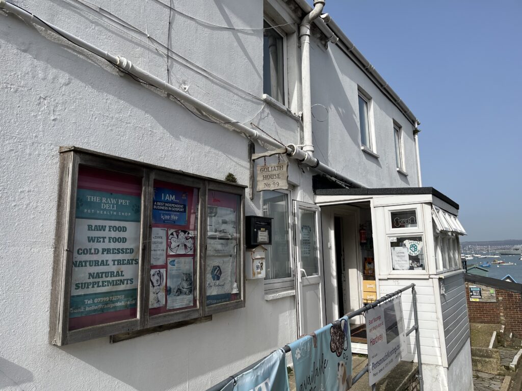
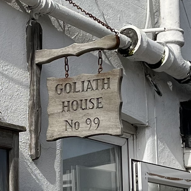
A café can be found at the top of the alleyway on the corner of Priory Road. This was for many years Hardway Marine, a yacht chandler’s, but prior to that, the building was a public house called The Goliath.
Further north along the foreshore, at the site of another hard is the Quay Lane boatyard. Once the home of a number of retired WWII motor torpedo, or motor gunboats, which were converted into houseboats.
There was a bakery, Greens, which perfumed the area with the smell of fresh bread. It stood where the new housing in Moraunt Close, Kyon Close and Alencon Close now stand.
Dyers Dairy occupied the area where Castle View now stands. Their electric milk floats would leave the dairy very early in the morning to deliver milk to homes all over Gosport.
George Kingsbury’s was an engineering company based in Quay Lane, Hardway which now trades as Kingsbury UK. The company specialises in machine tools.
Offshore one can often see Royal Navy vessels moored, usually awaiting sale. In the 50s and 60s the whole creek was filled with ships and submarines, mothballed, and known as The Reserve Fleet. Mothballing involved covering the guns with gas tight and waterproof covers, all hatches were sealed and the ship pumped with a gas to ensure that everything was preserved. The vessels were inspected regularly to make sure that all was well. At the time of writing, the moorings were occupied by four Type 23 frigates. There were also a number of wooden warships, moored opposite The Jolly Roger, which collectively were known as HMS Fisgard a training establishment.


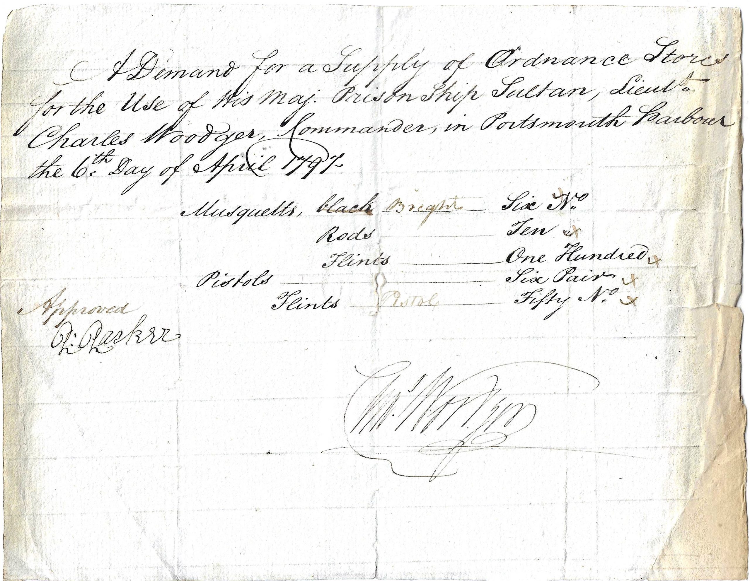
Going back in time these same moorings were occupied by prison hulks. These were retired, large wooden warships, two or three deckers, devoid of their guns and rigging, which housed prisoners, some awaiting transportation to Australia, often for minor offences. As can be seen from a document, dating from 1797, from Lt. Woodger, commanding HMS Sultan asking for stores, these hulks were commanded by a mere Lieutenant. Living conditions aboard were extremely poor and many prisoners did not see the end of their sentences alive. Some inmates even ended up being buried on Burrow Island.
The final hard is located near the entrance to Frater Lake. Very few people venture this far north as above the high tide mark is M.O.D. property, well guarded, but the brave and venturous can walk to it at low tide as long as one walks below the high tide mark.